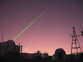
Satellite Laser Ranging (SLR)
WEBSITE:
Satellite Laser Ranging (SLR) is a fundamental measurement technique used by the NASA Space Geodesy Program to support both national and international programs in Earth dynamics, ocean and ice surface altimetry, navigation and positioning, and technology development. NASA continues to maintain and operate five trailer-based Mobile Laser Ranging Stations (MOBLAS) and two compact Transportable Laser Ranging Systems (TLRS) at fixed sites.

