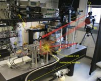
Swath Imaging Multi-polarization Photon-counting Lidar (SIMPLE)
WEBSITE:
The Laser Remote Sensing and the Planetary and Geodynamic Laboratories are partnering on the Swath Imaging Multi-polarization Photon-counting Lidar. SIMPL is an airborne prototype that demonstrates laser altimetry measurement methods and components that enable efficient, high-resolution, swath mapping of topography and surface properties from space. SIMPLE is the most efficient way to do laser ranging. It is a push-broom laser altimeter that includes four laser beams, each having a green and near infra-red component. One of SIMPL's major functions is to advance laser altimetry measurements of the cryosphere process in the polar regions.
Key Staff
- Instrument Scientist: Philip Dabney

